Use these buttons to see some of the interesting geology of Timor-Leste
Mapping Timor Leste
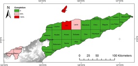
GeologyThe University of Melbourne has begun working with IPG to map Timor at 1:50,000 scale. The Atauro and Dili sheets are complete, and data is in hand for the Laclo and Oecussi sheets.
Maps and images Geology of Atauro 1:50,000 Geology of Dili Region 1:50,000 Geology of Laclo Region 1:50,000 |
Minerals
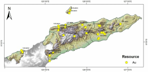
Timor-Leste has an almost undeveloped but prospective minerals industry.
The links below are for maps that show the distribution of mineral occurrences across Timor-Leste based on the report by UNESCAP - Atlas of mineral resources of Timor-Leste. The UNESCAP report is based largely on out-of-date geological understanding and the University of Melbourne will continue to evaluate the prospectivity of Timor-Leste Data Spreadsheet for UNESCAP maps Maps and images Gold-Silver-Copper Chromium-Iron-Manganese |
Hazards
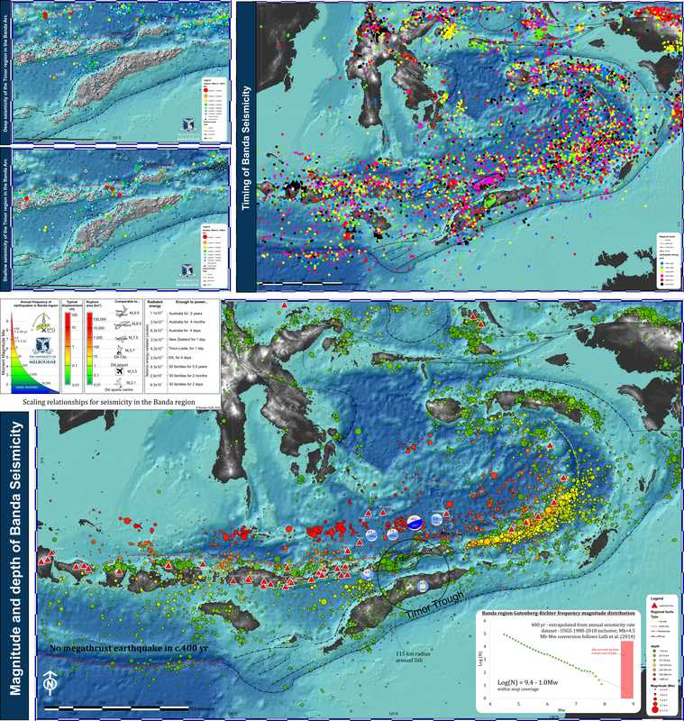
Timor-Leste has a severe landslide hazard in areas with steep terrain and high rainfall. The landslide hazard will be evaluated along with seismotectonic hazards as part of the Timor-Leste geological mapping project
Data Landslide inventory (2005) shapefile Maps and images Landslides and rainfall distribution Landslide frequency distribution Elevation/slope distribution of villages Landslide map Seismicity map Reports Landslide report based on shapefile above (2011) 
|
Related sites and resources
This list provides links to resources concerning the relevance of geological mapping to the development of Timor-Leste:
'Comprehensive' risk assessment by the Asian Disaster Preparedness Centre
World bank report on Timor-Leste's infrastructure expenditure
2011 program to strengthen disaster risk management in Timor-Leste - completely ignores mapping of hazards
UNESCAP - mineral resources of Timor-Leste
'Comprehensive' risk assessment by the Asian Disaster Preparedness Centre
World bank report on Timor-Leste's infrastructure expenditure
2011 program to strengthen disaster risk management in Timor-Leste - completely ignores mapping of hazards
UNESCAP - mineral resources of Timor-Leste