FaultRock - structural geology, (neo)tectonics and engineering geology
  • Home
    • About me
  • Photos
    • Timor Leste >
      • Timor PhD field work
      • Timor 2016
      • Timor 2017
    • New Zealand >
      • Greendale fault photos
    • Australia >
      • Cape Conran, East Gippsland
      • Cape Liptrap
      • Northern Queensland
  • Publications
    • Journal Articles
    • Conference contributions and industry presentations
    • Popular science
    • Theses and other
  • Research interests
    • Australian Earthquakes
    • Timor mapping project
    • Timor-Leste engineering geology >
      • Diapirs and mud volcanoes
      • Timor-Leste coastal erosion
    • Applied Geology >
      • The Pyramid project
      • Engineering geology
      • Geohazards
    • New Zealand earthquake geology
    • Teaching >
      • Unimelb MGeo >
        • Graduate programs for Engineering Geology
        • Virtual field trip Studley Park
      • Field camp teaching
      • Lectures
      • Useful links
    • Collaborators
  • Contact
  • Blog

Diapirism and mud-volcanism in Timor-leste

Engineering geologists are concerned with the distribution of earth materials and water, and how that impacts engineering projects. Timor-Leste's geological survey (IPG) has several talented engineering geologists but more will be required to cope with the volume of work required in a country that has a rapidly developing infrastructure and very active surface processes. 

Diapirs and mud volcanos

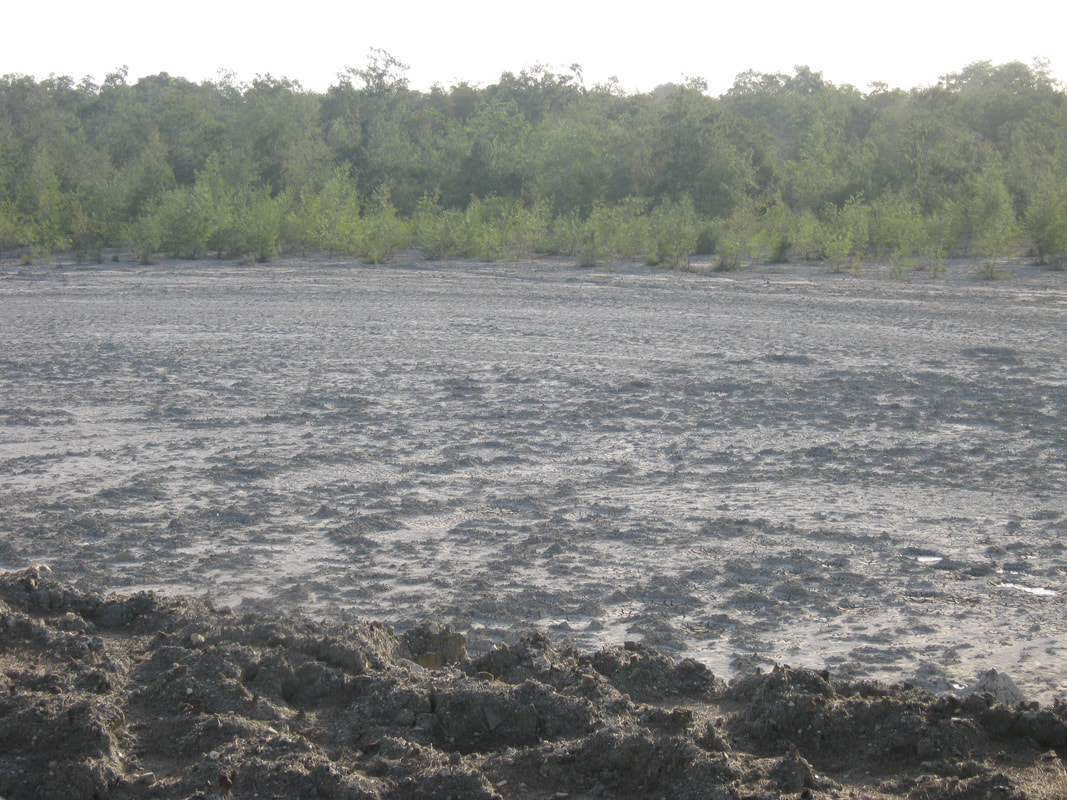
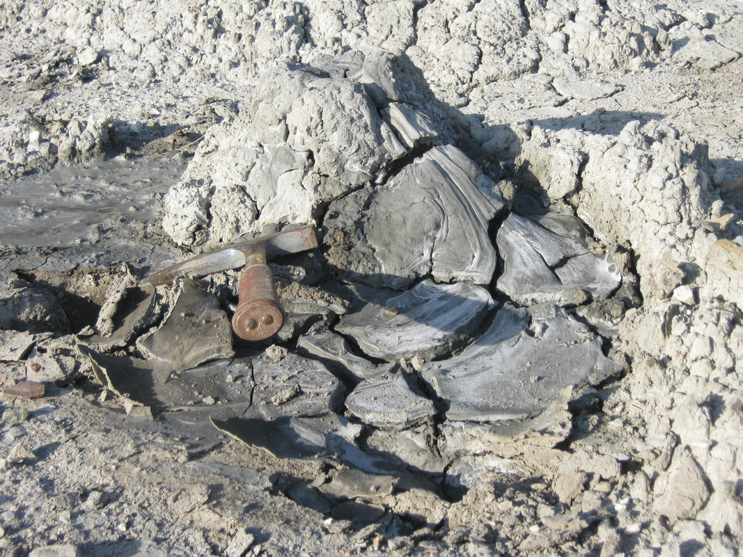
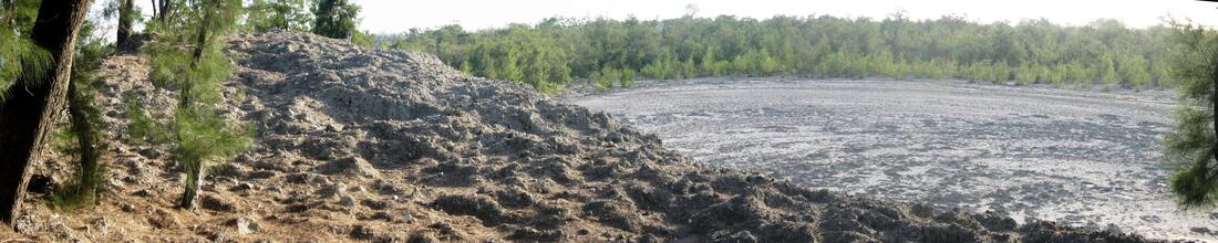
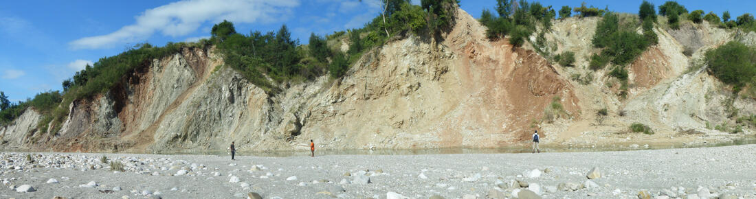
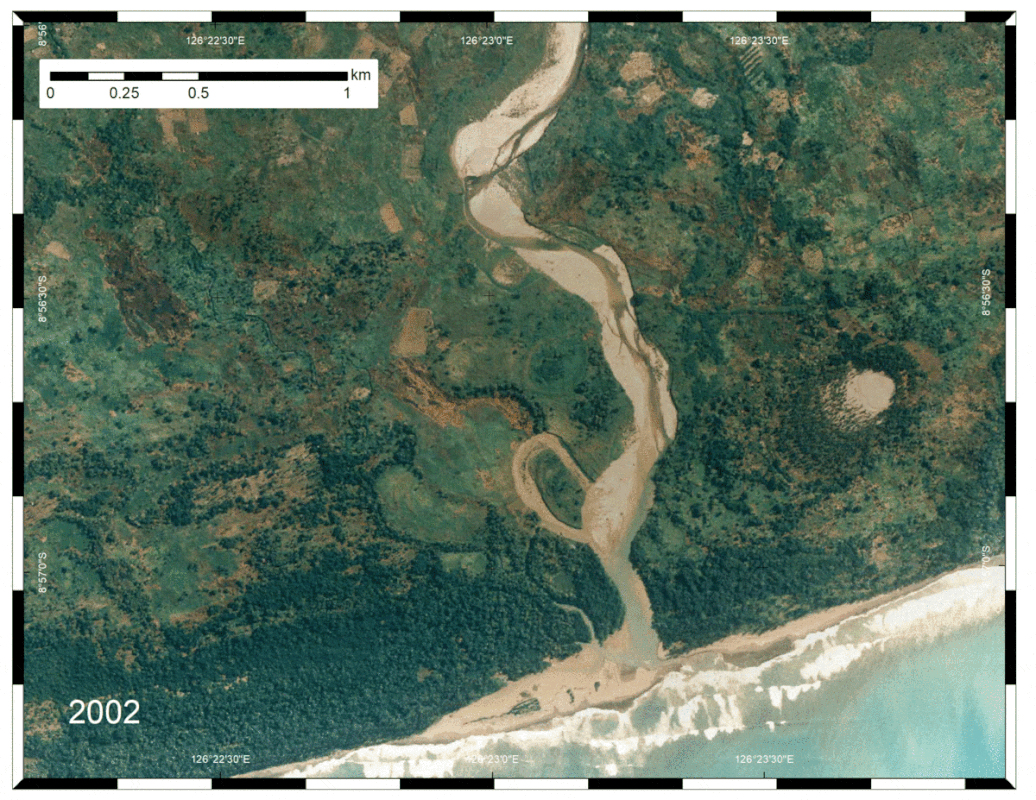
 Diapirs (both active and inactive) are common on the south coast of Timor. These photos show an active mud-volcano (Raitahu) and an inactive diapir (Cuha River south of Viqueque). The map GIF shows an animation of the Raitahu mudvolcano between 2002 and 2012, and reveals displacement at the vent and bulging close to the coast. The river responds dramatically as it meanders strongly on the upstream side of the bulging diapir.
This site is located very close to the proposed LNG plant.
Life is too short to look at ugly rocks
  • Home
    • About me
  • Photos
    • Timor Leste >
      • Timor PhD field work
      • Timor 2016
      • Timor 2017
    • New Zealand >
      • Greendale fault photos
    • Australia >
      • Cape Conran, East Gippsland
      • Cape Liptrap
      • Northern Queensland
  • Publications
    • Journal Articles
    • Conference contributions and industry presentations
    • Popular science
    • Theses and other
  • Research interests
    • Australian Earthquakes
    • Timor mapping project
    • Timor-Leste engineering geology >
      • Diapirs and mud volcanoes
      • Timor-Leste coastal erosion
    • Applied Geology >
      • The Pyramid project
      • Engineering geology
      • Geohazards
    • New Zealand earthquake geology
    • Teaching >
      • Unimelb MGeo >
        • Graduate programs for Engineering Geology
        • Virtual field trip Studley Park
      • Field camp teaching
      • Lectures
      • Useful links
    • Collaborators
  • Contact
  • Blog